The health of our guests is a top priority. Learn more about our response to COVID-19
Learn about our response to COVID-19

logo ×

  • This field is for validation purposes and should be left unchanged.

Getting to Whistler

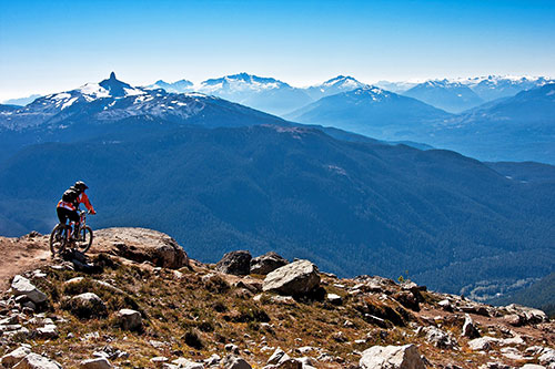
Set within one of the most spectacular ranges of the Coast Mountains in British Columbia, Whistler is easily accessible by car and is approximately two hours from Vancouver. In fact, your vacation in Whistler begins as you set out on your journey, with the Whistler Sea to Sky highway providing one of the most scenic and unique drives in the world. The 115km (70 mile) route will take you past the Howe Sound, Squamish Chief, Mount Garibaldi and the Tantulus Range as you weave along breathtaking mountain roads, through lush valleys, and past sleepy villages.

The journey from Vancouver airport takes just a little longer, at around 2.5 hours depending on traffic and weather conditions. Again, you will travel along the Whistler Sea to Sky highway (otherwise known as the BC-99) and Whistler is sign-posted for much of the journey. However, for more detailed instructions on the journey, use Google Maps to plan your route or print out a copy of our directions listed below:
 

Directions to Whistler from Vancouver International Airport

  • Take Grant McConachie Way E to Granville St in Vancouver (5.3 km)
  • Head northwest on Grant McConachie Way E (54 m)
  • Keep right to stay on Grant McConachie Way E (3.1 km)
  • Keep left to stay on Grant McConachie Way E (1.3 km)
  • Continue onto Arthur Laing Bridge/Marine Dr SW (170 m)
  • Keep right at the fork, follow signs for Granville Street E/City Centre/Centre-ville/BC-99 N and merge onto SW Marine Dr
  • Continue onto Granville St (6.8 km)
  • Continue onto BC-99 N (1.0 km)
  • Keep right to stay on BC-99 N, follow signs for Nanaimo & Gibsons/Whistler (1.4 km)
  • Turn left onto W Georgia St/BC-1A/BC-99 N/BC-99A N – Continue to follow BC-1A/BC-99 N (6.4 km)
  • BC-1A/BC-99 N turns slightly right and becomes BC-1A N/BC-99 N (450 m)
  • Turn right onto Taylor Way/BC-1A/BC-99 – signs for Squamish/Whistler (1.2 km)
  • Use the left 2 lanes to turn left toward Trans-Canada Hwy/BC-1 W/BC-99 N – signs for Trans Canada Highway/BC-1 W/BC-99 N/Horseshoe Bay/Squamish/Whistler (120 m)
  • Use any lane to take the Ferry Terminal ramp (250 m)
  • Merge onto Trans-Canada Hwy/BC-1 W/BC-99 N (10.3 km)
  • Keep left to continue on BC-99 N (102 km)
  • Turn right onto Village Gate Blvd


    Other website Links, Whistler and Vancouver

    ACCOMMODATIONS & LODGING WEBSITES

    Whistler Select
    Outpost Whistler

    VANCOUVER WEBSITES

    City of Vancouver
    Public Transit
    Travel Smart
    Vancouver International Airport – YVR